OK, BUT FIRST MUST ADMIT TO DOING MO[O]RE "TRAINING":


With the research car measuring the "pull" like we did in the late 70's with 2-10-4, T&P 610


OK, enough of the real, let's get onto the model railroad.
Below is the schematic of the track plan as the builders of the V&T Rwy now see it:

The names are real and the starting point for the layout [could be changed like so much else] between Hagerstown, MD to east Tennessee but bear no resemblance in location to each other other than Hagerstown, MD, and Rockwood, TN. The numbers in RED are locations marked with little yellow sticky notes on the track plans [below]. The track plans were laid out on graph paper with two blocks [1/2 inch] = 1 ft. and curves and switches drawn out in that scale. There are three basic levels. Starting at the top, Hagerstown staging [1], is a 1.28% grade to Saltville [6] with Ozone [2] being level from switch to switch. The single ended tracks at Devonia [3] are on the level but the main behind them is on the grade [yes, a "holding" mechanism is needed on the main here].

Brimstone [4] and LaFollette [5] are on the grade since they are only holding tracks for complete trains, essentially staging tracks, and no switching done there. Saltville [6] is level. Saltville to Elza Gate [10], the bottom of the helix, is on a 2.8% grade and will require helpers for some trains.

ELEVATIONS
These grades put the second level, Saltville [6], at 58 inches [making the "nod under at the door at about 56 inches] and 5 inches under the top level, Hagerstown [1] at the door and the wall on the right entering the room [wall 4] [at 63 inches] .
The main level, below, is at 46 inches which includes ALL track shown below.

LENGTH OF RUNS
Gate City yard [11] to Dixianna [14] is 20 ft [0%rise]
Elza Gate [10] to Piney River [8] is 27 ft. [0%rise]
Gate City yard [11] to Saltville [6] is 37 1/2 ft. [2.8%rise] [helpers may be needed]
Saltville [6] to Hagerstown [1] is 75 ft [1.28%rise]
Which makes the mainline run from Gate City yard [11] to Hagerstown [1] 112 ft
ADDITIONAL 1 inch =1 FT plans to be done of the various towns/industries/switching areas which are are still being developed/finalized. For instance, the below three plans show possible options for Dixianna [14]/Morley [13] and Saltville [6] [these are at the 1/2 inch - 1 ft]:


SORTA PROVING THE TWO DIMENSIONAL PLANS:
To confirm that these two dimensional plans were "do-able" when built, one level over the other, a 3D 1" [four squares] = 1 ft model was built. Graph paper was glued to the foam-board "wall" so all three dimensions scaled out. Matboard was cut to for the layout surface and held in place with straight pins through the foam-board "walls".
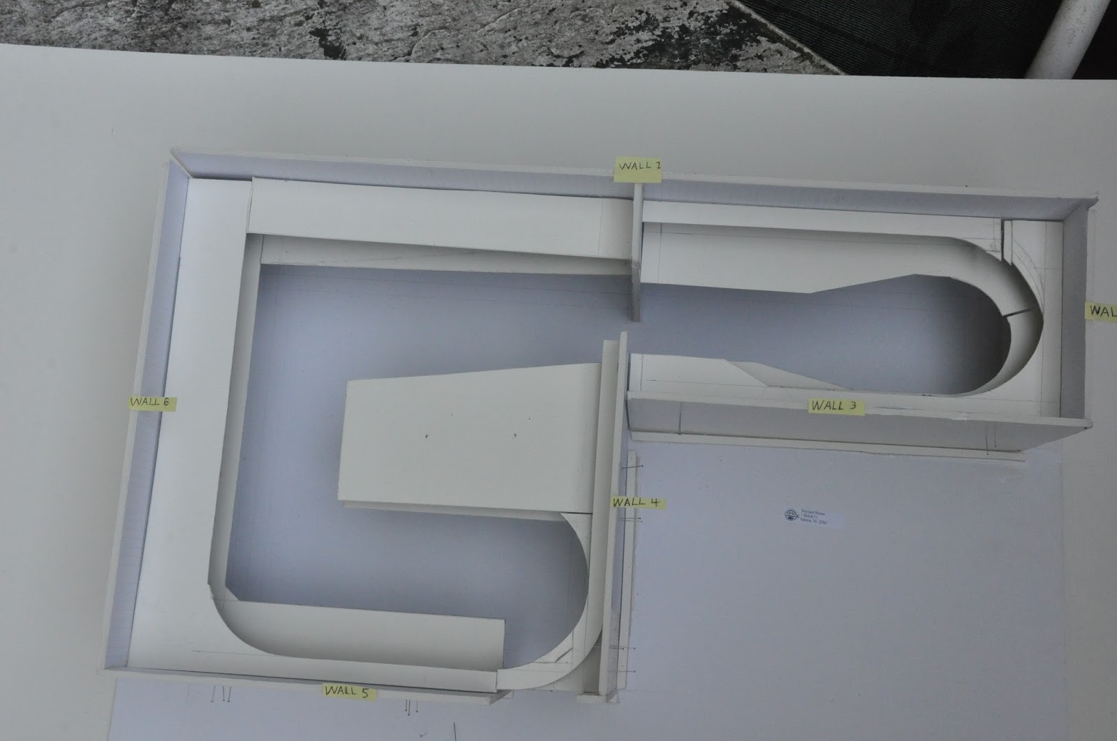


Here is a close up of a couple of the wall surfaces showing two and three levels:


OK, finally got this to where it should be posted, 3:03 am, and will start on cleaning up some things this morning. Bye, bye or "Good Day, mate"